

Features AGTEK SmartDirt
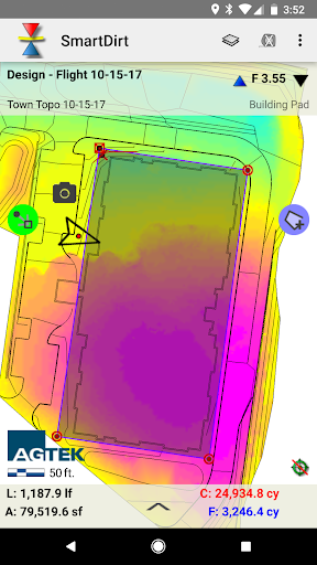
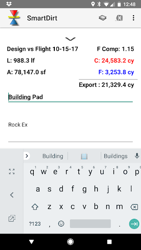
SmartDirt uses your AGTEK takeoff to display the geo-referenced 3D model, data lines, and plansheets on your iPhone or iPad.
Show Cut-Fill as you walk on the interactive grid map or switch to the plans as needed.
Select points to see elevations, coordinates, station & offset, point labels and approximate distance from your location.
Measure slope or distance with a tap or estimate earthwork quantities with the measure tool.
Take pictures, create notes, or create tracks that can be read by Sitework 4D or Google Earth.
Gaming Features
Enjoy immersive gaming experience with various game modes.
Food & Dining
Discover recipes and order food from your favorite restaurants.
Smart Home
Control and monitor your home with smart features.
See the AGTEK SmartDirt in Action
Get the App Today
Available for Android 8.0 and above